
A lot of people are also posting on the forecast cold air outbreak across the central and eastern US late this week and into next week. This is definitely a big story, and I look forward to getting into it in the days to come. For a preview of this event at the earliest stages of its prediction, I refer you to Patrick Marsh's blog and Chris Whitehead's blog, both of which look into this cold air outbreak.
However, Seattle and much of the west coast looks to be spared this frigid air. In fact, this morning was rather hazy in the Seattle area, but according to the weather service that's not where the big problem area was...
 |
| Fig 1 -- Watches, warnings and advisories map for eastern Washington from the NWS WFO Spokane. |
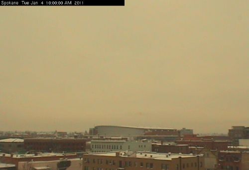 |
| Fig 2 -- Downtown Spokane webcam at 10 AM PST, Jan 4th, 2011. From the Spokane Air Quality website. |
So what kinds of environmental conditions promote this "air stagnation" that traps pollution? Several things play a roll. First, the topography of the region has a huge impact on whether air gets trapped or not. Eastern Washington is particularly vulnerable to these kinds of events because it sits inside a topographic "bowl" with higher terrain all around.
 |
| Fig 3 -- Topographical map of Washington state. Greens represent lower terrain while browns represent higher terrain. |
An area of low terrain like that is excellent for trapping air and pollutants because it becomes much harder to evacuate the air due to horizontal advection. At low levels, air will be stopped by higher terrain no matter which horizontal direction it heads. If the lapse rates are very stable (like we see when there is an inversion aloft or widespread subsidence), the air won't be able to rise up and over the higher terrain to get out either. Therefore, absent any strong synoptic-scale forcing, the air in the low levels simply can't get out of the basin.
So do we see those kinds of conditions here today? Here's this morning's 12Z sounding out of Spokane:
 |
| Fig 4 -- KOTX sounding out of Spokane, WA at 12Z, Jan. 4th, 2011. From the HOOT website. |
 |
| Fig 5 -- Surface observations from eastern Washington at 17Z, Jan. 4th, 2011. From the UW Regional Observations website. |
Let's briefly look at the larger scale to see what's promoting this pattern. Here's the analysis of 300mb winds as 12Z this morning from the UW 12-km WRF:
 |
| Fig 6 -- UW 12-km WRF 300mb wind (shaded), temperature and geopotential height analysis for 12Z, Jan. 4th, 2011. From the UW WRF page. |
Fortunately this pattern looks to be somewhat progressive and the ridge will soon be replaced by an approaching trough over the northeastern Pacific in the next few days. This should bring some wet weather to the western side of the Cascades and snow to the Columbia Basin.
Good subject to write about! I had to mention this for my radio forecast I did for KPDT this afternoon. Most people probably didn't have a clue what I meant by an "air stagnation advisory" haha
ReplyDelete